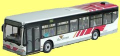
One reader of 'Moving Limerick' has a good point, one i often pondered myself.
Why is there no route map of the limerick bus system. How is a visitor to the city supposed to find out how to move around? Information seems to be on a word of mouth basis only.
Busing Limerick is a challenge even for those who regularly take the bus, for example: Getting a bus to the Crescent Shopping Centre, probably the buses most popular destination.
People are used to riding the 304 to the Crescent. Every second time i am on a 304A (Raheen via Greenfields) i hear someone panic questioning what bus they have gotten (and on that some drivers go straight up Hyde Rd others turn right and branch onto it later, confusing people more) and then virtually no-one knows that the 312 Ballycummin bus drops off to the crescent even though it is in fact the only bus service that mentions the Crescent Shopping Centre.
After the Raheen bus which I take daily I really couldnt tell you much about any of the other routes, Bus Éireann only give destinations, they need to provide maps of the city highlighting all the stops and routes.
ALSO, they should have an onboard speaker telling you where you are. Most people not used to getting a particular bus dont know when they are where they should be.
AKA, a voiceover "This is Crescent Shopping Centre, next stop Fr. Russell Road" followed by "This is Fr. Russell Road, next stop Regional Hospital"
I once thought a bus was heading from UL into the city and out to Raheen, by the time we had arrived in Moyross I figured we were mistaken, luckly the driver understood and let us stay on the bus for the return journey for free. Have you ever ended up on the wrong bus or gotten lost?
